Maximize
Maximize
Maximize
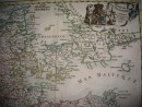
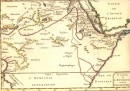
MAP OF THE LOWER PART OF INDIA below the GANGE containing the Isle of Ceylon, the coasts of Malabar and Coromandel ; with the country between those coasts : Map extracted from the Philosophical and Political History of Établissmens and Trade of the Europeans in the two Indies . Compiled by Rigobert BONE , hand watercolor , 31.5 x 21 cm. Very good condition , mounted under a mat .SOLD
30 other products in the same category: